October 2021 Snow Report Lake Tahoe
Bringing an official end to the drought, Northern California is receiving much needed precipitation over the next few days. Meteorologists are calling it an atmospheric river and it is bringing snow to Lake Tahoe early in 2021.
The system will affect Northern and Central California and southern Oregon, as well as the Sierra. In the lower elevations, wind gusts will average 40-60 mph with gusts up to 120 mph in the High Sierra.
End to Wildfire Season
“This rainfall is coming about a month ahead of average and will be very welcome in fighting the remaining fires, particularly in Northern California,” AccuWeather Chief Meteorologist Jon Porter said. “Repeated storms delivering such copious rainfall will have a major effect on the wildfire season – effectively ending the wildfire season from Northern California northward,” Porter added.
Over the weekend, we expect to see snow levels holding steady around 11,000 feet and dropping to 10,000 feet by Sunday. Overnight Sunday, snow levels are expected to drop to 8500 feet and as low as 5000 feet by Monday morning. The system is bringing colder air, so the excessive rain in some areas will turn to snow.
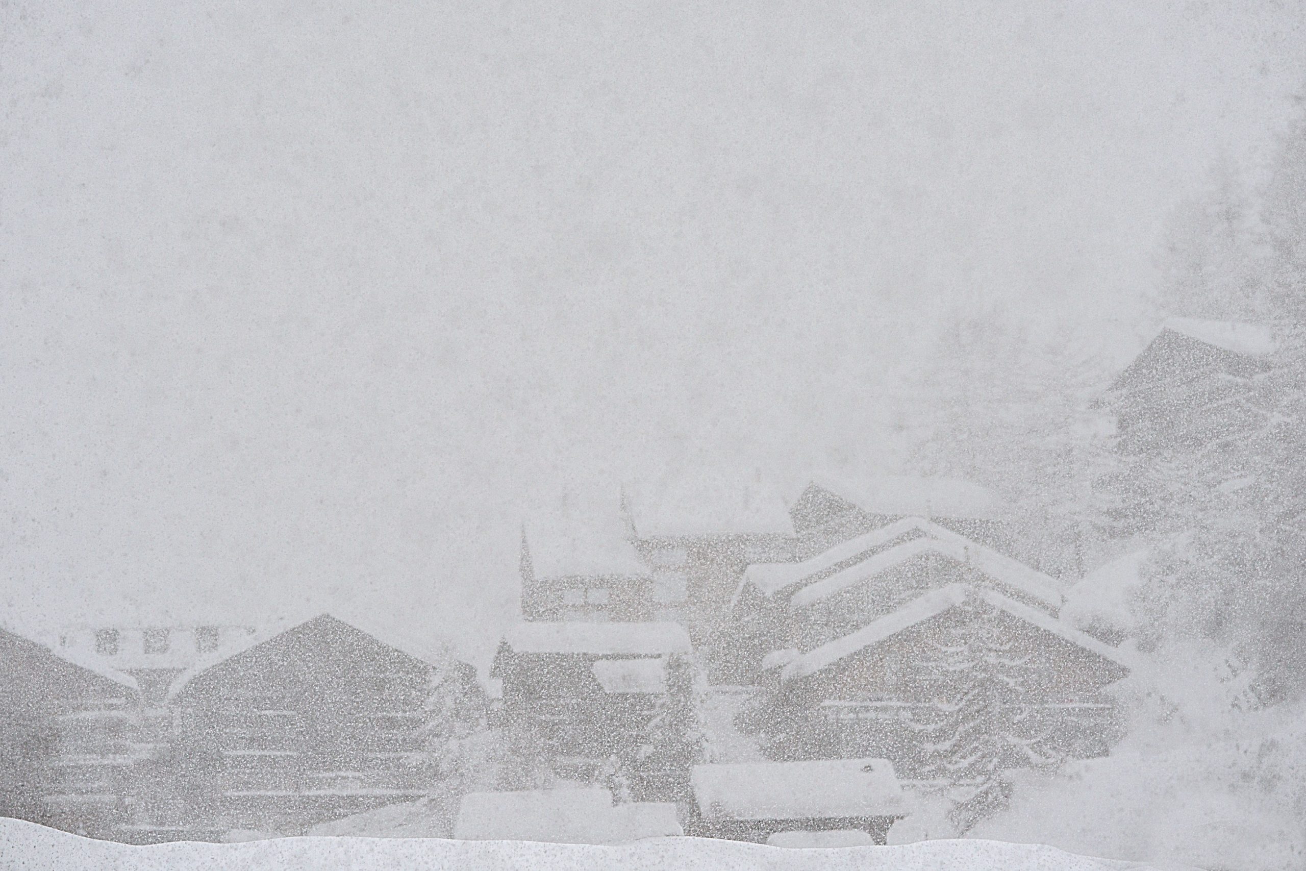
As Northern California will get much needed rain, the colder air arriving with the storm will bring snow to elevations above 8,000 feet. AccuWeather Meteorologist Rich Putnam predicts 5 to 8 feet of snow at the major ski resorts at Lake Tahoe.
Travel over Donner Pass along I-80 in California, will see a changeover to snow Sunday night, and heavy snow will continue to fall through Monday night. There is the potential for 1-2 feet of snow which will make driving conditions hazardous. Already, the storm has impacted many of the roadways in Northern California with falling debris and road closures.
Winter Storm Warning Issued
The National Weather Service issued a Winter Storm Warning from 5pm 10/24/2021 Sunday to 11pm Monday 10/25/2021 above 7000 feet at Lake Tahoe,
Accumulations of 4-8 inches are expected for Donner Pass and Echo Summit, 3-5 inches for Spooner Summit, 12-18 inches for Mount Rose Summit and multiple feet of snow for higher mountain elevations. While Truckee and the Tahoe Basin may only get rain, there is a 30% chance of 6 inches of snow falling by Monday evening.
Wind gusts of 50 mph will be felt across the basin with ridges gusting well over 100 mph. We are hoping that this system might establish the base for additional snow making that might allow ski resorts to open early in 2021.
Long Term Forecast
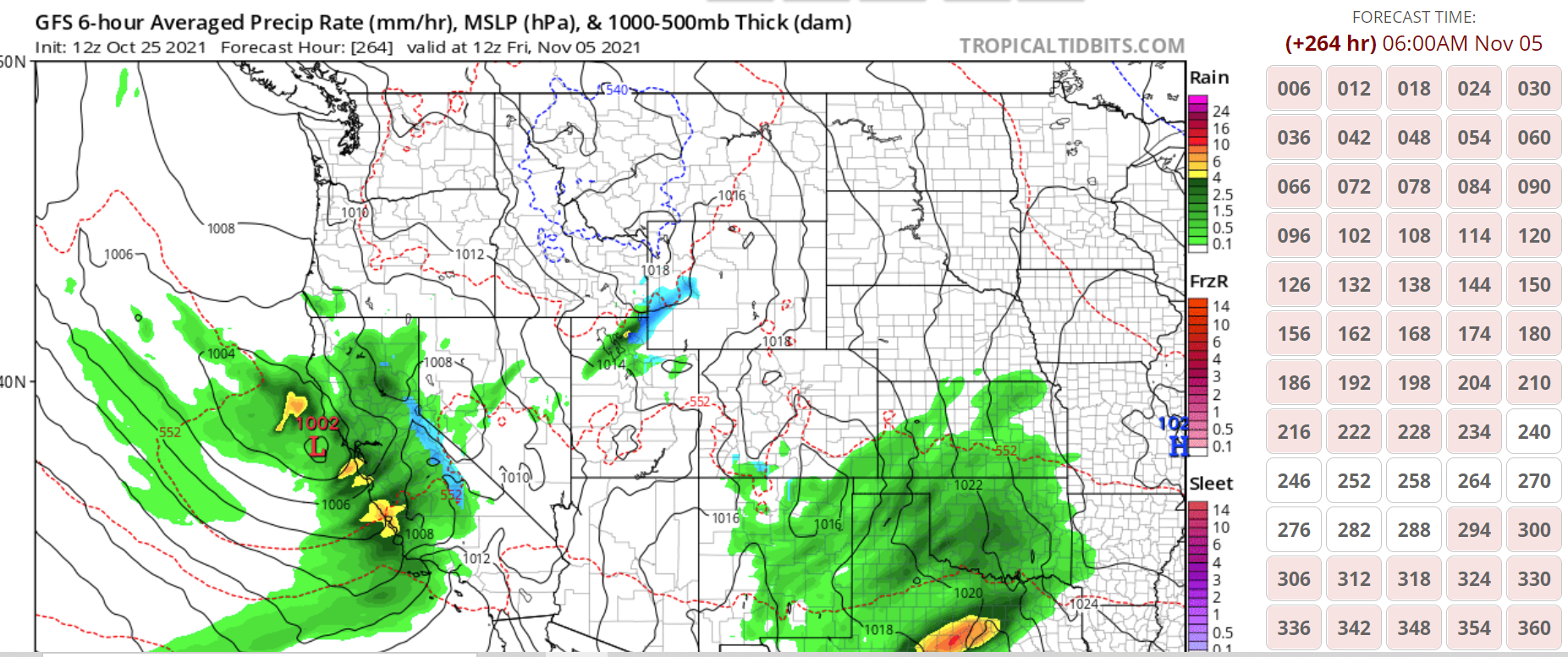
Beginning around November 5th-10th, 2021, we expect another major system to impact California and the Lake Tahoe basin. The above graphic is provided by www.tropicaltidbits.com and shows heavy rain for Northern California, with snow (in blue) in the Sierras. November 8th and 9th should see the heaviest snowfall. Of course, these forecast models continue to change – so be sure to check back for up-to-date information.
The latest storm exceeded everyone’s expectations and snow levels dropped to 7000 feet on Sunday and down to 5000 feet in some areas.
Stay tuned for the latest weather updates for the Lake Tahoe 2021/2022 ski season. As we welcome winter to Lake Tahoe, we are hoping for a strong La Nina winter.
The Inn Shop is located next to Plump Jacks in Palisades Tahoe (formerly Squaw Valley Ski Resort.) We offer ski and board rentals and are ready to serve you!